
KATHMANDU/NEW DELHI: The wounds left by the devastating glacial flood in Nepal are deepening, with the pain and destruction echoing along nearly 200 kilometres of the river corridor from Gyirong in Tibet to Trishuli in Nepal.
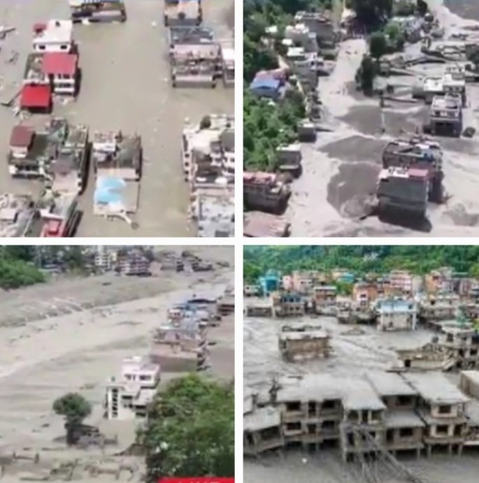
More than 500 people are now reported dead and thousands remain missing, while entire bazaars, riverside roads, bridges, fields and settlements have been buried under mud, boulders and uprooted trees.
The disaster is increasingly being described as a cascading Himalayan catastrophe, triggered by the sudden release of an enormous volume of water following a rock-ice avalanche and glacial collapse.
Experts cited in the discussion estimate that around 20 million cubic metres of water may have been released within a very short period, producing a flood wave of extraordinary speed and destructive power.
The immediate tragedy, however, may not be over.
Fresh Barrier Lake Raises Alarm
A newly formed barrier lake upstream of the affected area has become a major concern. Reports indicate that the lake was holding more than 2.5 million cubic metres of water, equivalent to roughly 1,000 Olympic-sized swimming pools, with its volume continuing to rise.
Chinese state media has reported that the barrier lake had begun overflowing, forcing rescue operations to be temporarily suspended. Forecasts cited in the reports suggest that several million cubic metres of additional water could enter the lake over the coming days.
The fear is that a sudden breach could unleash another powerful flood downstream, threatening already devastated communities and infrastructure around the Gyirong and Trishuli river systems.
Authorities have therefore urged people to move to higher and safer ground and remain away from river channels and vulnerable low-lying areas.
A Flood Unlike a Normal Flood
The extraordinary danger lies in the character of the flood itself.
This was not simply a gradual rise in river levels caused by rainfall. A huge volume of water, mixed with ice, mud, rocks and debris, was released almost instantaneously. The resulting surge behaved more like a moving wall of debris than a conventional river flood.
Reports have described the resulting mud as resembling “liquid concrete”, making conventional search-and-rescue operations extremely difficult.
Roads normally used to reach remote communities have disappeared or become impassable. Rescue agencies have been forced to rely heavily on helicopters, drones and other air assets while ground teams attempt to clear routes through debris.
The United Nations has described the immediate priorities as locating survivors, deploying emergency response teams and then providing medicines, healthcare, drinking water, sanitation, food and temporary shelter to displaced families.
The Himalayan Warning
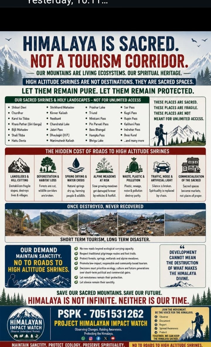
The catastrophe has also revived a larger question: how much disturbance can the Himalayan ecosystem withstand?
The affected region sits in one of the world's most fragile high-altitude environments, where glaciers, permafrost, steep slopes, rivers and rapidly changing climatic conditions interact.
A glacial lake outburst, landslide or rock-ice avalanche in such terrain can trigger a chain reaction—blocking a river, creating a temporary lake, suddenly releasing stored water and sending an enormous debris-laden flood downstream.
That makes such events potentially transboundary disasters.
A hazard originating high in Tibet can affect Nepalese communities many kilometres downstream and potentially place infrastructure, hydropower projects and settlements farther along the river system at risk.
China's Infrastructure Under Scrutiny
The disaster has inevitably intensified scrutiny of China's rapidly expanding infrastructure network across the Tibetan plateau, including roads, tunnels, hydropower projects and other construction in extremely high-altitude terrain.
Critics argue that infrastructure development in such ecologically sensitive areas must be preceded by rigorous geological, glaciological and environmental assessments. Any alteration of drainage channels, slopes or fragile mountain systems can potentially amplify the consequences of a natural event.
At the same time, India and Nepal are themselves undertaking infrastructure development in the Himalayan region, making the larger issue one of regional environmental governance rather than simply a China-versus-India argument.
What is becoming increasingly difficult to ignore is that Himalayan hazards do not respect political boundaries.
Early Warning Becomes Critical
The latest danger reinforces the need for a joint Himalayan early-warning mechanism involving China, Nepal, India and other downstream countries.
Satellite monitoring, glacier surveillance, river-level sensors, seismic monitoring, drone reconnaissance and real-time communication could provide precious hours of warning if a dangerous lake begins filling rapidly or a landslide blocks a major tributary.
In a disaster where millions of cubic metres of water can potentially be released within minutes, every minute of advance warning can mean the difference between evacuation and catastrophe.
The devastation stretching from Gyirong to Trishuli is therefore more than a single flood disaster. It is a warning about a rapidly changing Himalayan environment where one event can cascade across borders, destroy infrastructure hundreds of kilometres downstream and leave communities fighting through mud, boulders and debris for survivors.
With more than 500 dead and thousands still missing, the immediate humanitarian crisis remains enormous. But the newly formed barrier lake has added another layer of fear: the Himalayas may not yet have finished delivering their warning.